According to the information provided by the authorities of the Captaincy of Puerto, they indicate that the tropical storm ‘Cristina’ is moving away from the continental mass to become a category 1 hurricane today, a phenomenon that does not represent any risk to the half peninsula, however, it will leave feeling their effects.

Likewise, they notified that due to the presence of this phenomenon in the Mexican Pacific at 12 noon on Thursday, July 9, the port will be closed to navigation to smaller vessels, this due to the passage of the tropical storm, waiting for rains, strong winds and high storm surge, a situation that will increase when this meteor becomes a hurricane.
The Naval Sector Maritime Weather Analysis and Forecast Center indicate that the displacement of this atmospheric disturbance is towards the Northwest at a speed of 18 kilometers per hour.

According to the weather forecasts, rains are expected in the south of the state, so the community must be vigilant and take extreme precautions.
Likewise, tropical wave No. 14 will move over the southeast of the national territory, where it will produce a potential for showers and strong point rains accompanied by electric discharges.

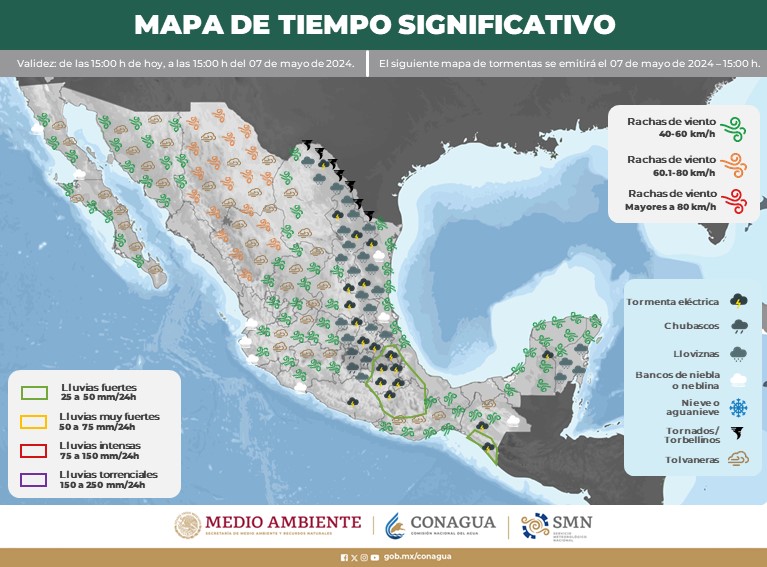
On the other hand, a low-pressure channel in interaction with the entrance of humidity from the Pacific Ocean will generate very strong occasional rains in the north, strong punctual over the northwest, with some showers in the center of the country, including the Valley of Mexico, all with electric shocks.
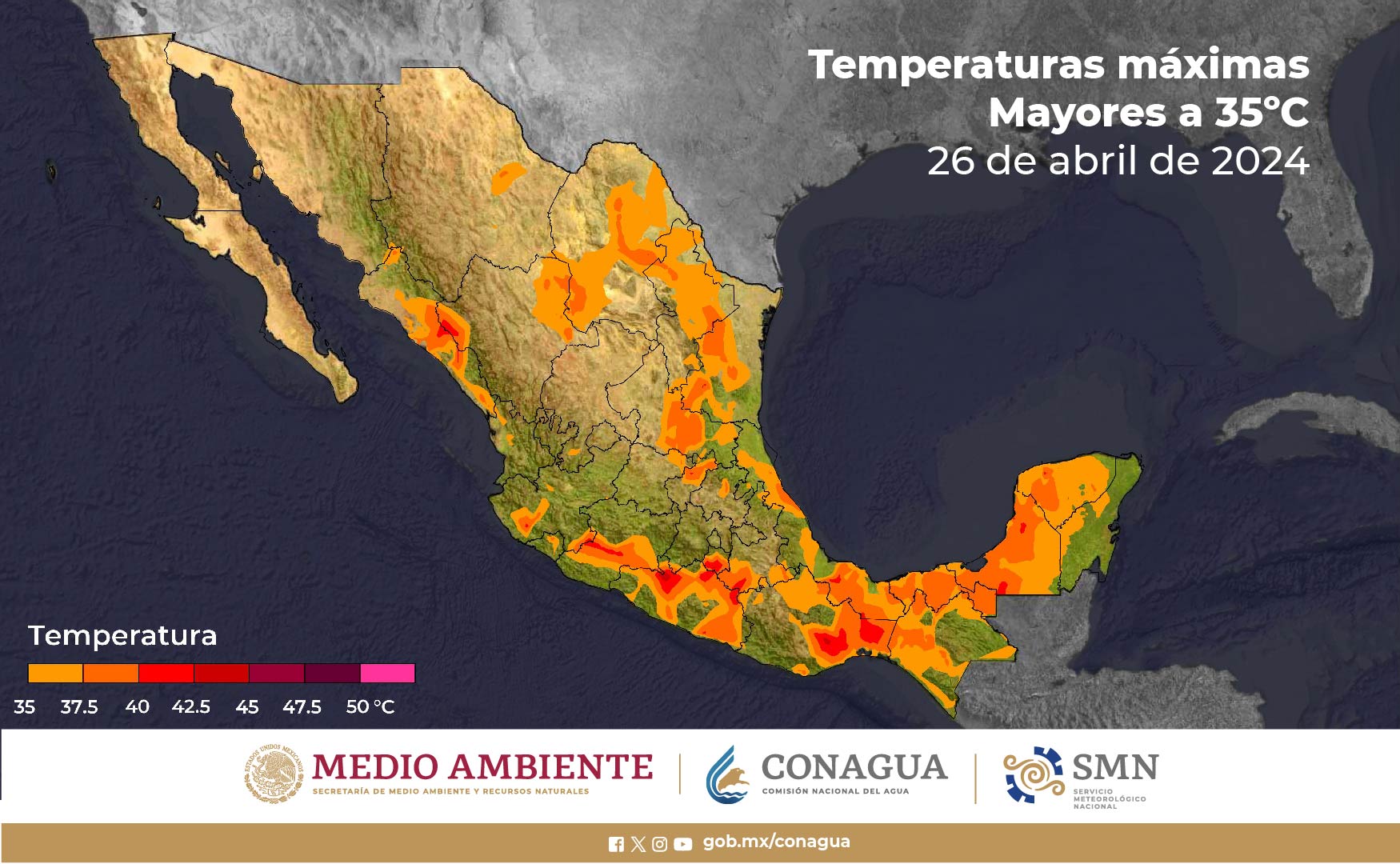
Finally, maximum temperatures above 45 ° C are forecast in areas of Baja California (north) and Sonora (northwest).
Heavy rains with very strong points (50 to 75 liters per square meter): Jalisco, Colima, Sinaloa, Durango and Zacatecas.

Intervals of showers with punctual heavy rains (25 to 50 liters per square meter): Baja California Sur, Sonora, Nayarit, Michoacán, Chiapas, Chihuahua, Aguascalientes Guanajuato, Querétaro, Hidalgo, State of Mexico, Veracruz, Campeche, Yucatan and Quintana Roo .
Intervals of showers (5.1 to 25 liters per square meter): San Luis Potosí, Morelos, Puebla, Tlaxcala, Guerrero, Oaxaca, Tabasco and Mexico City.
Isolated rains (0.1 to 5.0 liters per square meter): Coahuila, Nuevo León and Tamaulipas.
Baja California Peninsula: Clear sky most of the day and no rain in Baja California; Partly cloudy to cloudy with heavy rain showers in Baja California Sur (south). Extremely hot environment in the north of the region. Wind from the south component of 20 to 30 km / h, with gusts of 50 to 60 km / h in the southern Gulf of California, which will be accompanied by waves of 2 to 3 meters in height on the coasts of Baja California (southwest and south).
North Pacific: Partly cloudy sky in the morning and an increase of cloudy in the afternoon, with very heavy occasional rains in Sinaloa and heavy punctuals in Sonora, accompanied by electric discharges. Very hot environment. Wind from the southern component of 15 to 30 km / h in the region, with gusts of 50 to 60 km / h in Sonora.
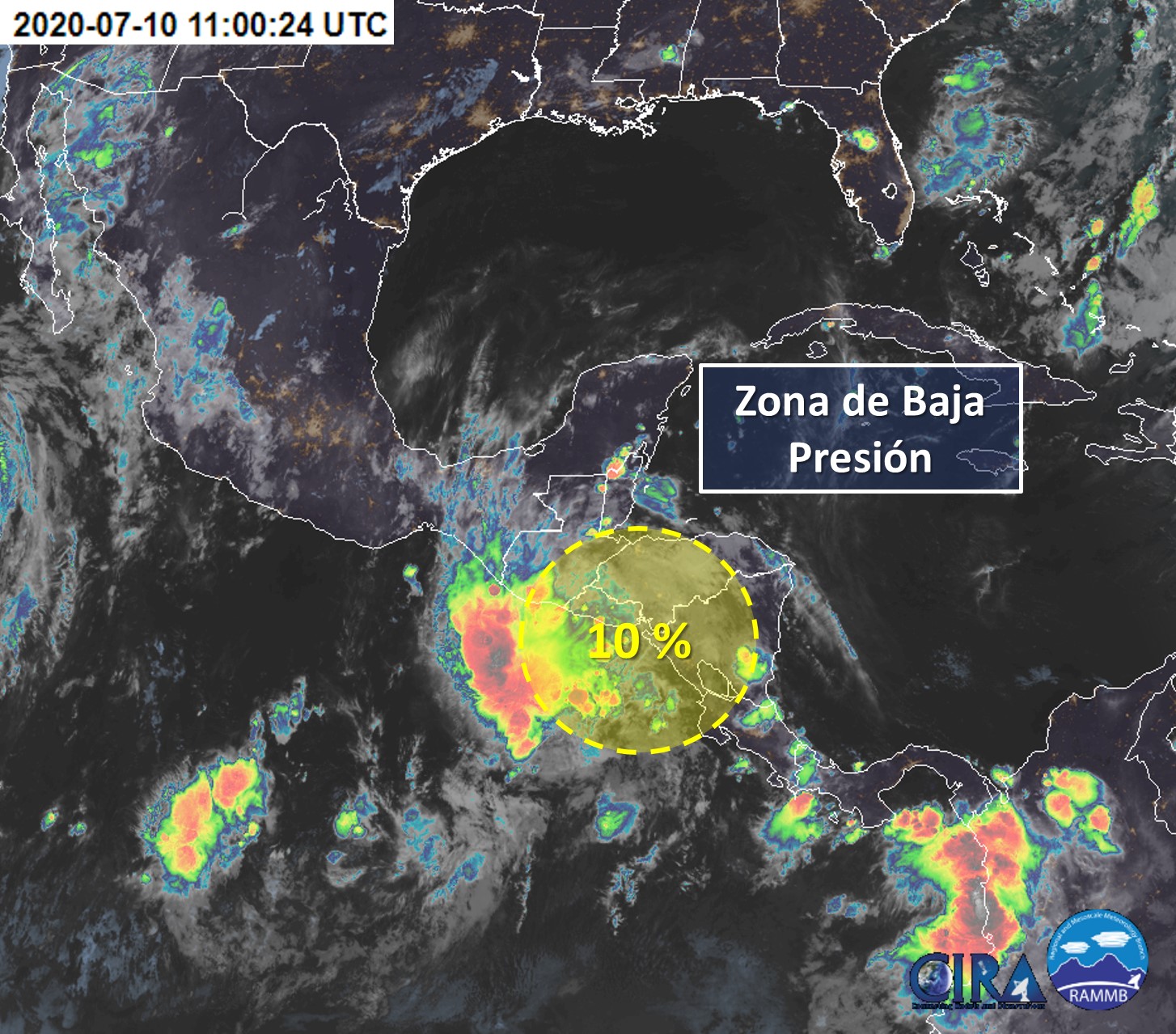
To the south of the coasts of Michoacán, a low-pressure zone is kept under surveillance, which maintains sixty percent of cyclonic development.
Source: tribunadeloscabos.com.mx, smn.conagua.gob.mx
The Mazatlan Post


